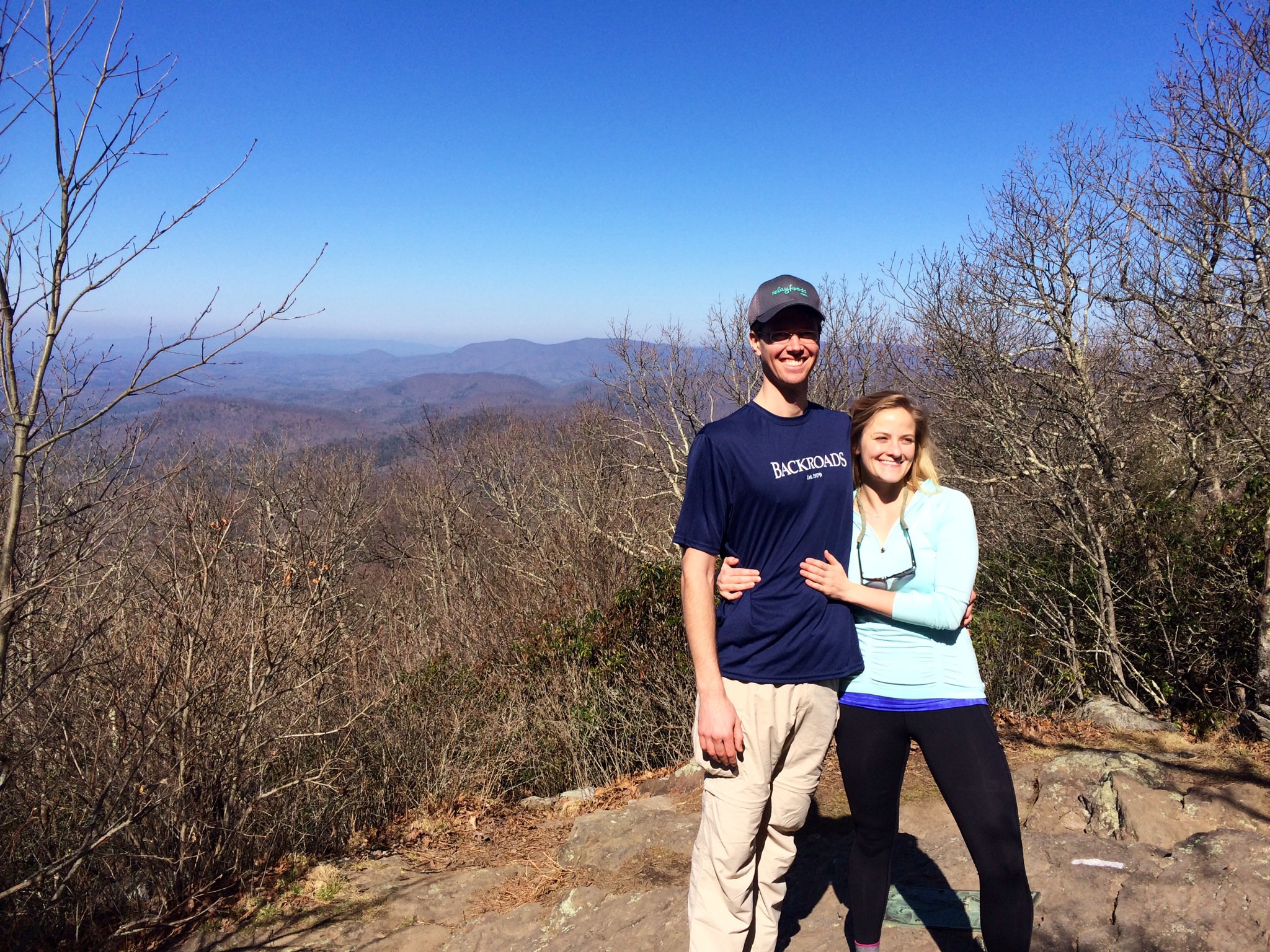
Brandon summits Humpback rock in 2012. Humpback is near Charlottesville, VA, and isn’t far off the AT.
We came across this funny and informative article on the Appalachian Trail from CNN and wanted to share it with you — enjoy! (Also, check out our new “Trail Glossary” in the menu above. We’ll add to it as we go!)
OK — to pick up after the foggy hike over Blood Mountain…
George and Logan completed the AT together in 2009. Did we mention that they’re awesome? (Photo courtesy of George)
After ten miles of hiking in fog as thick as pea soup, it was a relief to arrive at Neels Gap and see our friends, Georgeanna and Logan, who own Mountain Crossings outfitter and hostel. This is the same Georgeanna (everyone calls her George) and Logan mentioned in our “Made possible by” section — they have been integral in helping us plan and execute this trek.
George is college friends with Katherine’s brother-in-law, and she immediately took us in like family. She fed us, dealt with our blisters, and introduced us to the rest of the crew. Pretty much everyone who works at Mountain Crossings has thru hiked the Appalachian Trail at least once, so they know their stuff [one of the employees — trail name ‘Squarl’ — is about to be a ‘Triple Crowner’ — meaning he will have thru hiked the AT, the Pacific Crest Trail (PCT), and the Continental Divide Trail (CDT). Amazing].
George, Logan & the awesome crew at Mountain Crossings (minus Jason). You guys are real American heroes. (photo courtesy of George)
Their signature service is the ‘shakedown’ — where they rummage through a hiker’s belongings and extract unnecessary items/weight. On average, they are able to trim 12 pounds from a load! Fortunately, we didn’t need to be shaken down since we had their expert advice from the start. Thanks George, Logan, and the gang for the hospitality, the pizza, and for spending a significant amount of time lying prone on the floor sizing up Katherine’s foot arch 😉
The next day we hiked in the crisp mountain air along beautiful ridge lines with amazing views. We met many spring breakers (kudos for spending your break in the mountains at mother nature’s whim instead of a booze-filled beach), received fresh fruit from a trail angel, and saw the first signs of spring on the forest floor (click through the gallery below).
Some fun guys!
View from Cowrock Mtn.
The signs of spring are slowly appearing in the woods
Us after a nice lunch on Wolf Laurel Top — thanks spring breaker for takin’ the pic!
We camped by a creek that evening and were in our sleeping bags by 6:30pm to stay warm. With ample time until sundown, we finished off the brandy (thanks, Uncle George!) and made up stories about talking potatoes and panda escapades. All in all a good day.
The next day was a monster of a hike for us. We knocked out fourteen miles from Hogpen Gap to Unicoi Gap — making it there a day ahead of schedule! Highlights included more breathtaking views of North Georgia’s mountains, and Katherine accidentally flinging her shoe off of a boulder. Yep. That happened. Guess who had the pleasure of retrieving it?
What’s wrong with this picture?
Brandon valiantly retrieves Katherine’s lost shoe. Le sigh.
14 mile day?! that’s right!
Unfortunately, the fourteen miles did a number on Katherine’s already sore knee. Fortunately, we had been planning to stay with friends in Hiawassee, GA — and they came to the rescue!
Beth and David welcomed us with open arms, food and margaritas!
The view from Beth and David’s house in Hiawasee, GA. Life is hard there…
Beth and David are Katherine’s family friends, and they graciously swooped us up from Unicoi Gap to spend the weekend at their lovely home on Lake Chatuge in Hiawassee. We were able to rest our weary, swollen feet and oh, did we feast! Over the weekend we ate ribs, steak, chicken, sausage, twice baked potatoes, pizza, salad, fruit, biscuits, and most notably — porkchops for breakfast! Not to mention the homemade margaritas.
Our break from the trail lined up well with March Madness, so we were able to watch lots of basketball (bummer Tar Heels… but way to go Hoos!). We also visited a local vineyard where we sampled Georgia wine and randomly ran into George enjoying her day off with a friend — it’s a small hiking world. It was the perfect weekend for rest, recuperation, and ribs. Thank you Beth and David for sharing your beautiful home with us and filling us to the gills with delicious food and energy for the hike ahead!
The hike from Unicoi Gap was a challenging two-summit day — first climbing 1000′ to the top of Rocky Mountain, then another 1,500′ climb over Tray Mountain.
View from the summit of Tray Mountain.
… annnnd the other view from the summit!
Fortunately, they were split up by the most amazing trail magic to date — thanks to Carla and Dave. Fueled with burgers, hotdogs, fresh fruit, spinach salad, and mini cupcakes, we made it to Tray Mtn. Shelter in high spirits. We met several other hikers there, including Copernicus (trail name given for spotting the first star after several overcast days), North Star (his friends dropped him off at Springer Mtn. with directions to “follow the north star”), Borrego (his hispanic coworkers thought his hair looked like sheep’s wool), Gramps (in his twenties, but has the knees of an old man), Gaucho (recently wandered around Argentina), and reunited with Walk In Tree — the deaf and peripherally blind hiker from our first day! Again, a small hiker world.
It was our first night actually sleeping in a shelter, and ’twas a good thing we did… the early morning hours brought an inch of snow! Very pretty and very cold.
Our view from the Tray Mountain shelter first thing in the morning.
Our humble abode atop Tray Mtn.
All snug as bugs in rugs. Thanks to the three loud snorers, we had no fear of becoming bear burritos 😉
We woke up and were like, “Snoooow! prettttyyy!” then we remembered we have to live and hike in it. And we were like, “Oh.”
Bear bags hangin’ in the snow.
‘Borrego’ retrieves his bear bag to make some breakfast.
Snow art
The trail meandering through the melting snow.
We spent the day hiking from one side of the mountain ridge line to the other. On the sunny side, the snow had melted, the wind was calm, and we actually had to remove clothes to avoid getting too hot. Then we would switch to the other side of the mountain, and it would immediately change from spring to winter — high winds greeted us with snow in our faces, and we would be grateful for an uphill climb to keep our blood pumping. Needless to say, it was a wild day to be in the woods. We made a few videos to give you a sense of what it was like, but they really just give you sense of our nerdiness:
And we found a bench by a creek. Quaint:
A tiny bench in the woods!
Tall man on a tiny bench in the woods!
Katherine’s knee was still acting up pretty badly (limping on every downhill), so to prevent risk of further injury, we got a shuttle from Dicks Creek Gap back into Hiawassee where Katherine’s mom met us.
Which brings us to now. We are back at Katherine’s parents’ house in Cleveland, TN giving Katherine’s knee plenty of time to heal. We’re planning to take a week off, with much rest, ice, elevation, and light exercise thrown in the mix. Despite our slightly sputtering start, we’ve conquered seventy miles of the trail in eight days of hiking, and we’re on the cusp of entering North Carolina. So stay tuned, because we’re coming back harder, better, faster, stronger.
Signs of spring are slowly appearing in the woods.
After our fourth day of hiking, we camped alone for the first time since starting the trip. Up until that night, we had set up camp around a shelter and around other people.
[Let’s digress for a moment: There are 250 shelters spread out along the AT, all maintained by trail crew volunteers. They are generally open faced structures with a roof that can sleep anywhere from 7-15 people (most we’ve seen look like this, but apparently there are fancy ones like this!). Shelters usually include a nearby water source (streams etc), a privy (like this or this), and campsites around it for those who can’t fit or don’t want to stay in the shelter. It’s apparently possible to do the AT without a tent, because the shelters are generally spread out within a day’s hike of one another (although some are as far as 30 miles apart… quite a day’s hike). The downside of shelters is that they can be grimy and rodent-infested when hikers don’t clean up after themselves, and they can be crowded. The upside of shelters is that they have privies and a water source; they are the best places to stay dry in rainy weather; and they are a great place to meet and talk with other hikers.]
SO, while we had spent our first three nights around a shelter, our fourth night was the first night that we camped completely alone. We found our spot and started our routine of settling in — putting up the tent, getting fresh water, changing into our camp clothes, making dinner, cleaning up, flossing and brushing our teeth (shout out to our dentists!) and setting up our bear bag. We’re definitely getting better and more efficient at setting up camp, but at this point we were only four days into our trip and parts were still a bit… clumsy (like finally hanging our bear bag well, and then excitedly beginning to collect wood for a warm fire… only to realize we left the lighter in the bear bag).
When you’re in a situation that is new and unfamiliar — and you aren’t totally sure of yourself yet — there’s an unease that can creep up on you. It tends to come on once you sit still for the day and notice the sun is about to dip below the horizon. We talked about this feeling that night as we lay in our tent, and we decided it’s basic homesickness. It’s a yearning for what’s familiar as you adjust to your new norms. It’s getting used to falling asleep despite the abrupt noises you hear in the woods (“was that a raccoon or a bear?”). It’s waiting for processes that seem to take so long now (setting up camp and packing back up) to become second nature. It’s waiting to hit your stride.
But, the Trail has an answer for poor homesick hikers like us: TRAILMAGIC.
Dave and Carla — the king and queen of trail magic (in our limited experience).
TRAILMAGIC occurs when people (Trail Angels) go out of their way to help out unsuspecting thru hikers. Generally seen at a road crossing, Trail Angelsoften have beverages and/or an assortment of food (and good company) for weary hikers. Basically, however big or small the act, it’s an awesome display of kindness.
We’ve been fortunate enough to experience eight instances (almost one per day!) of TRAILMAGIC thus far:
1) We came across breath mints and a note to “Brandino and Kazo” at a stream crossing on our first day (from Katherine’s parents — remember this picture?). 2) On our second day we were having lunch with a few other hikers near a forest service road, when a woman pulled up in her SUV. She came out all smiles with a case of peanut butter crackers that she handed out while updating us on the weather to come. 3)After our second, crazy night (26 degrees and 40mph winds), we hiked past a group of AT veterans who were handing out Mountain Dew and beer. There’s nothing like Mountain Dew in mountain dew (Representatives of the Mountain Dew company – please ask our permission before adopting this slogan). 4&5)When we were at Mountain Crossings outfitting store, we had two free meals made for thru hikers — burgers grilled by a group from Mercer University and chicken casserole from a local church. 6)After our night of lone camping, we hiked to a nearby road crossing and met “Sherpa” — a minister who had hiked most of the AT and who was handing out fresh fruit. Fresh ANYTHING is gold on the Trail. 7)That same afternoon, as we finished a 14 mile day at Unicoi Gap, we came across a woman who had hiked the Trail in 2012. She was giving out cold Cokes and beer.
Dave and Carla’s ultimate trail magic set up.
8)While all of the acts of Trail Magic were so, so appreciated and wonderful — this one takes the crown. We were hiking from Unicoi Gap to Tray Mountain, and came to a forest service road crossing. Dave and Carla had posted up with three picnic tables and a truck loaded with food and drinks. Dave had a grill going and was taking orders for burgers and hot dogs with all the fixings. They also had apples, oranges, bananas, strawberries, grapes, a huge spinach salad, yogurt, cookies, candy bars, energy bars, tea, sodas, root beer, cream soda, Gatorade…Carla also had some basic first aid essentials that she was offering as needed. It was like we were seeing a mirage.
It’s acts of kindness like these that kick that feeling of unease and uncertainty in the butt. We have so much support from friends and family, and then to also have support from complete strangers? It’s mind blowing. We’ve heard a alot about the sense of community on and around the Trail, but you really have to experience it to understand its depth. It’s inspiring, and we hope to return the favor as Trail Angels in the future.
We thought it’d be nice to occasionally post the stats of our trip thus far. So, here ya go!
THE STATS TO DATE
Starting point: Springer Mtn, Ga Ending point: Dicks Creek Gap, Ga Miles hiked: 70.2 Days of hiking: 8 Longest day of hiking: 14 miles Shortest day: 5.2 miles Average miles/day: just under 9 Warmest temperature: 72° (on our first day) Coldest: 20° (on top of Tray Mtn at night) Birthdays celebrated: 1! Jars of peanut butter eaten: 1 Nalgene flasks of brandy finished: 1 Wildlife spotted: pileated woodpeckers, juncos, Chattahoochee Slimy Salamander, squirrels, small birds that we don’t know the name of, and we heard an owl. Coolest trail name: Copernicus (he got the name by spotting the first star after days of fog and rain) Aches & pains: blisters, swollen feet, chaffed/bruised hips, sore knees, sunburns, scrapes, and monkey butt… Margaritas consumed: 4 Vineyard visits: 1 Instances of trail magic: 8 (What’s trail magic, you ask? We’ll explain soon!)
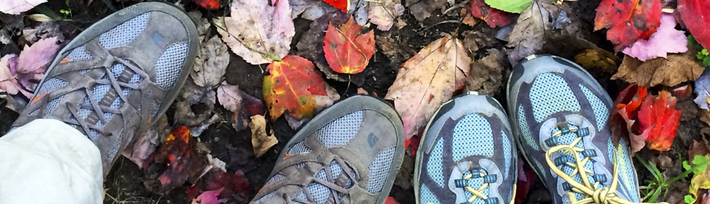
Longer post to come next week, but we wanted to share a photo gallery (click through below) from our first day back on the Trail last Wednesday. We ‘slack packed’ (where you leave your bag at your destination and only hike with some food and water for that day) the 11 miles from where we left off at Woody Gap to Neels Gap — and to our friends at Mountain Crossings.
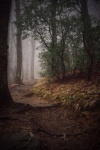
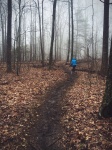
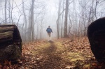
It was a good hike through the Blood Mountain Wilderness, though extremely foggy. This made the day eerily lovely, but we were a little bummed to miss out on the view from Blood Mountain. Hope to make it back one day. Again, longer update later — but we’re well and have finished 53 miles of the AT to date!
entering the Blood Mountain Wilderness
Always looking for that white blaze, the mark that will lead us to Maine
Katherine leads the way as we slack pack 11ish miles from Woody Gap to our friends at Neels Gap
Brandon heads into the mist
a ceiling of fog
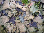
lovely licheny things
Lichen take 2
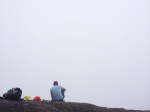
A hiker enjoys a lone lunch on a foggy overlook
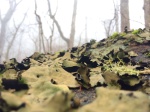
A sign of spring
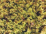
I’m mossy!
Moss so close you’ll get yer eyes wet…
We summited a misty Blood Mtn. No views, but still eerily lovely.
We took a few days off the Trail for a resupply/blister break (Katherine’s had blisters take her out of a trip before, and wants to avoid that at all costs). Breaks due to ailments and injuries are something we both expected, but Katherine was more than a little bummed this came on so soon. However, the blisters seem to be mostly toughened up, and we’ll hit the trail again tomorrow!
We’ll start where we left off — at mile 21 at Woody Gap in Georgia. We may be able to update the blog this coming weekend, but it may be more like two weekends from now. So, until next time, happy trails!
In prepping for the AT, veteran thru hikers emphasized that this trip will not only be comprised of unforgettable moments of beauty and joy — but will come with its fair share of discomfort, misery and frustration… to put it lightly. Both of us have taken decently long trips outdoors and understand that this is true, but it’s been a while since we’ve had such experiences.
Enchanted Mtn. Laurel grove
So, after a marvelously beautiful first day and night (70 degrees, gorgeous, bday cake, etc), the AT decided to give us a rude awakening. It started gradually, with a heavy rain the first night that lasted til the morning. It wasn’t too bad — we stayed dry in our tent — but trying to make breakfast, get fresh water, and pack up all of your gear in the rain is not an ideal situation (putting a soggy tent into a dry sack ensures it will be soggy when we take it out again – ugh). Yet, despite the rain and sogginess, we were in good spirits and ready to hit the trail once again.
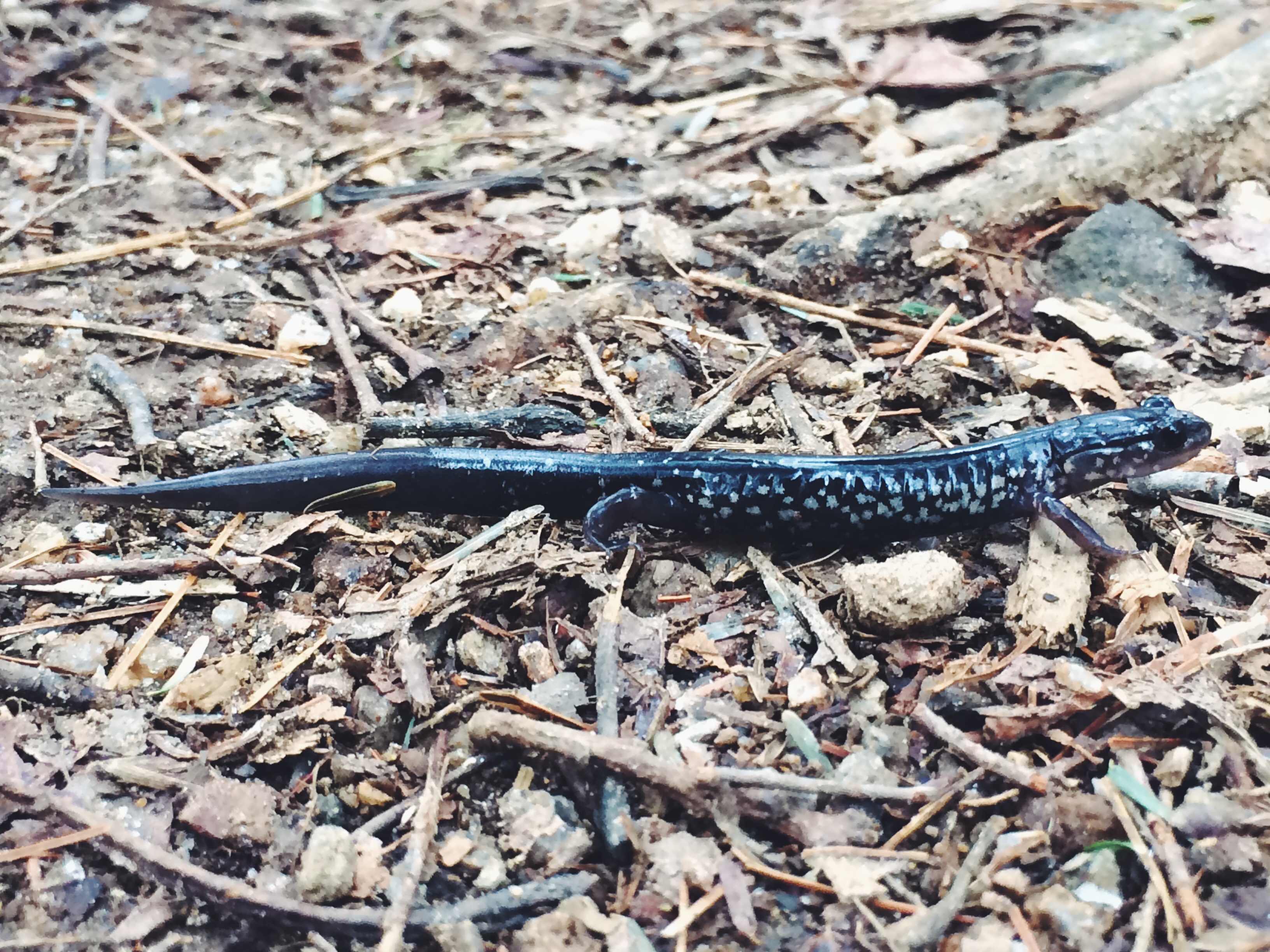
The rain cleared up and left a cloudy, windy day in its wake. It was nice hiking weather — much cooler than the day before, but nice and refreshing. We had a pleasant and challenging 8 mile hike on day #2 — encountering our first real climbs with back to back Sassafras and Justus Mountains (the two mountains to the right in this photo). We lunched with fellow hikers, enjoyed an enchanted forest of Mountain Laurel, and Katherine spotted a Chattahoochee Slimy Salamander with her eagle eyes:
Crossing the trail, a Chattahoochee Slimy Salamander!
It was shortly after seeing this salamander that you may say things took a turn for the ugly. We made it to Gooch Mountain shelter to find the shelter was already full, so we set out to find a spot to put up our tent. The campsites were nearly all taken except for a small one that was exposed on a hillside.
We mention that it was exposed because as we hiked into camp, the winds had picked up considerably and the temperature began dropping drastically. We set up our tent, but were wary of the strong winds and the big branches above us. Our sweaty hiking clothes were quickly cooling with the sudden temperature change, and Katherine couldn’t stop shivering. On top of that, she realized that the hot spots on her heels that she’d bandaged that morning had turned to full on blisters — never an uplifting sight.
Within a few hours of being at Gooch, the temperature dropped about 30 degrees. We changed into our dry, wool base layers that we only wear at camp — and Katherine had to retreat to her sleeping bag to get her shivering under control. Brandon was a HERO and got fresh water and made dinner while Katherine warmed up. He’s the best (this is Katherine, if you can’t tell).
We ate our dinner of mac and cheese mixed with tuna at the shelter, and talked with hikers such as Smokin’ Bear (hiking with terminal lung cancer and missing 1/2 a lung), Slow Poke (in his late 60s or 70s, hiking with 60 lbs), Rhode Island Red (also nursing blisters and hiking with his awesome dog), and Sling Shot (Appalachian State student spending his spring break on the trail). All we were talking about was the cold. It was getting so cold, and was only going to get colder. It was forecasted to get down to 26 degrees that night, and the winds were as high as 40 mph.
The two of us and another guy who was in a hammock decided that we shouldn’t be sleeping under the trees with winds that high. So, we retreated to the shelter and slept on the “kitchen” floor under the picnic table. We had a roof, gratefully, but the kitchen is open on all sides (if you look again at this photo, you can see where we were sleeping). Sling Shot tried to string up his tarp on one of the open sides of the kitchen, which helped some. Long story short, our AWESOME Western Mountaineering sleeping bags kept us warm, but we couldn’t avoid the sleet that the strong winds were blowing on our faces for a good part of the night.
So, night #2 was quite different than our first night — to say the least. And the next morning wasn’t easy either. Waking up in 26 degree weather and trying to get fresh water, cook, patch up blisters and pack up your gear — all with frozen hands… frozen everything — is not awesome.
BUT, here’s the good news. On rainy soggy and/or miserably cold mornings alike, all you want to do is pack up and get hiking. All you want is to be on the trail; to be moving forward. As soon as we hit the trail and warmed up the second morning, we were once again in good spirits and excited to be on the AT — slowly but surely walking toward Maine.
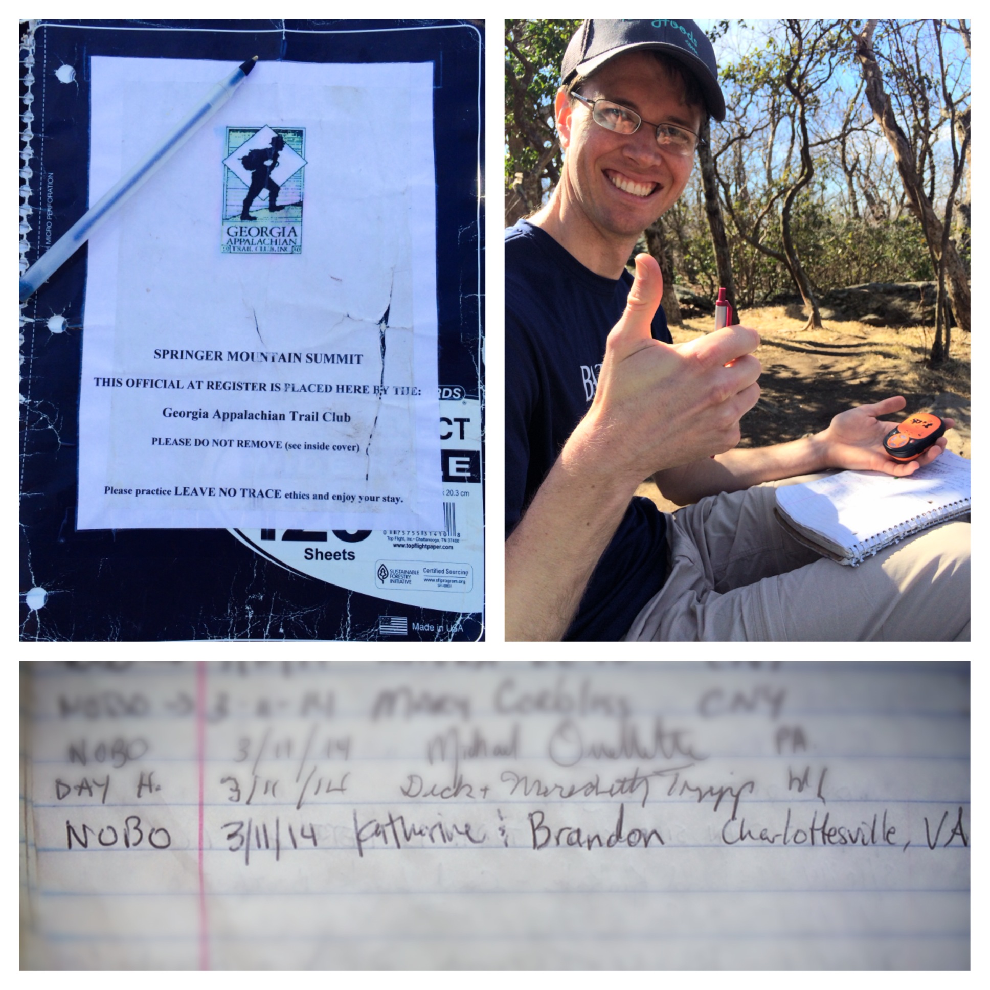
We arose before the sky was awake on Tuesday, March 11th for the start of our adventure. Katherine’s parents were kind enough to treat us to a Hardee’s breakfast and drive us nearly three hours to the trail head at Springer Mtn., GA. Actually, we drove to a parking lot at Mile 1 of the Appalachian Trail. There’s the option to drive to Amicalola Falls State Park and hike a 7 mile “approach trail” up Springer Mtn. to the start of the A.T…. but we’re not particularly interested in earning credit for extracurricular miles. Instead, the four of us hiked back a mile from the parking lot to the official start on Springer Mtn. There we officially signed the log book as thru hikers, took some photos, got super excited and retraced our steps back to Mile 1.
Signing the A.T. register/Checking in with our “Spot” GPS tracker
On top of Springer and so excited to get started!
We said our farewells to Katherine’s parents, and set out on our long walk in the woods. The feelings were surreal and amazing — we’d made it! After months of preparation and talk, we were finally walking. In the 8 miles we hiked, we experienced several landscapes — from barren, rocky hardwood ridge lines; mountain stream groves lush with rhododendron; to old pine forest whose floors were soft with pine needles. The weather was perfect, and we saw some birds — including two Pileated Woodpeckers!
Rhododendron grove.
Stream crossing! First of many.
Beautiful, old pines
We also experienced our first trail magic at a road crossing! Wonder who this was from….
Breath mint trail magic from Katherine’s parents!
We arrived at Hawk Mountain Shelter at the end of the day. Being the most convenient shelter within a day’s hike from Springer Mtn., it was very crowded when we arrived. Some of the fellow A.T. hikers we met included Cheezin’, Walk In Tree, Sweet Spot, and Blood (as you may have guessed, these are their trail names; we have not chosen/been given ours yet). Amazingly, Walk In Tree is hiking the trail deaf and peripherally blind – he earned his trail name from his preponderance for walking into trees.
The shelter was already full, so we set up our tent at a nearby campsite and immediately took our boots off in favor of our Bedrock camp shoes.
Get ‘dem boots off!
Home sweet home
We refreshed our water supply, cooked dinner and had delicious blueberry cheesecake (courtesy of our friend, Molly Damm) to celebrate Katherine’s birthday. After hanging our bear bag, we made a campfire and sipped brandy (courtesy of Uncle George) as we recounted highlights of the day. All in all, a beautiful start to our adventure.
P.S. We awoke to quite a surprise in the middle of the night. A helicopter flew in from the horizon and circled a ridge right by the camp site for about half an hour. We thought it might be a rescue mission for a lost hiker, but we found out the next day from a pair of uniformed men that an Army Ranger School is based in that area. Evidently, helicopter flybys and fake machine gun fire is an everyday occurrence. Who knew?
Holy moly. It’s here! In about eight hours, we are going to load up the car and Katherine’s parents are going to kindly drive us the 2.5 hours to the start of the trail. Pretty unreal! BUT, before we step foot on the historic trail, here’s a GEAR POST for all you gear nerds!
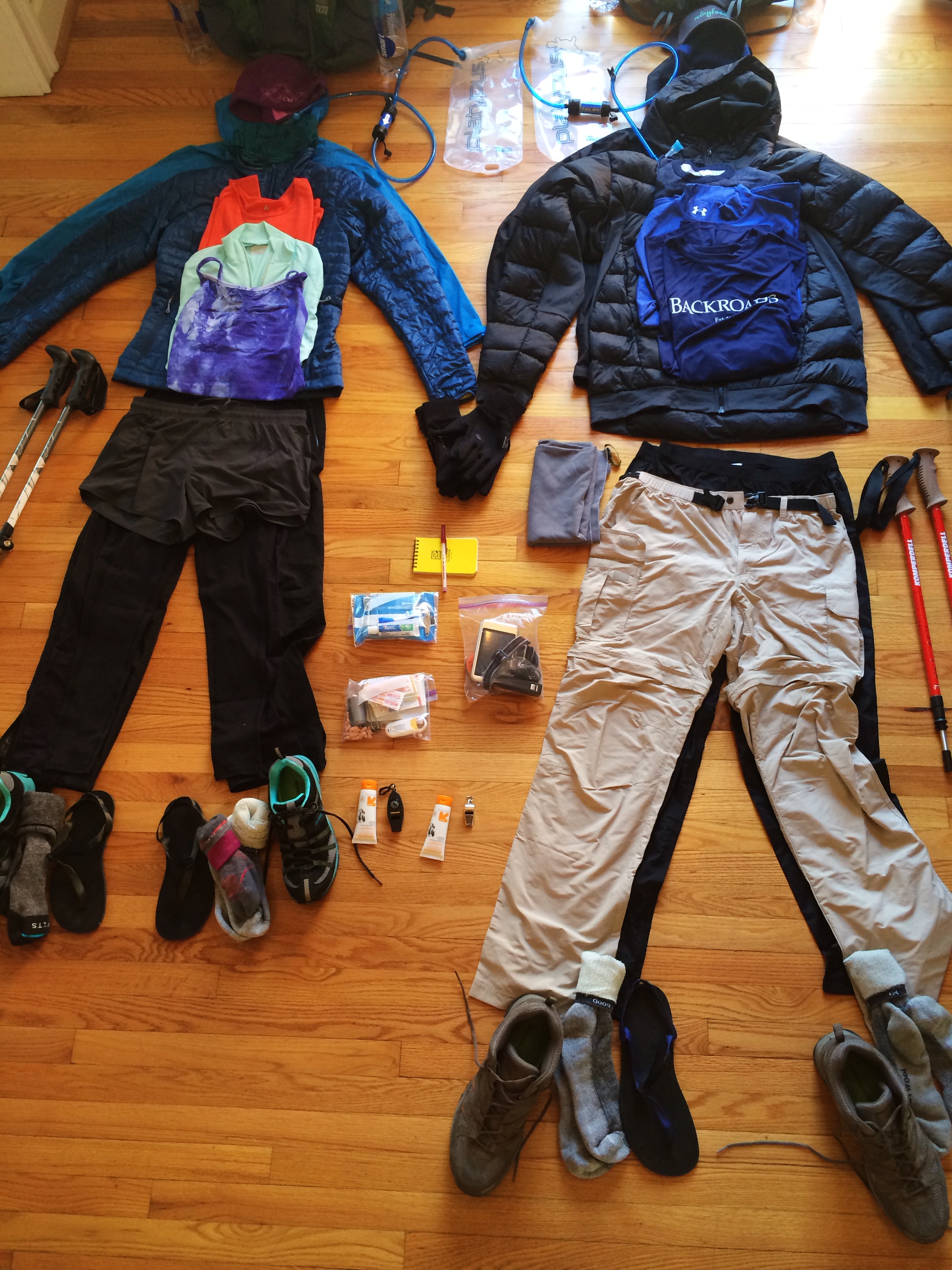
The photo up above is pretty much all of our starting gear, plus the food for one day. Our full packs will weigh around 35 lbs on day #1 and will only get lighter as we eat! Anyway, here’s the breakdown:
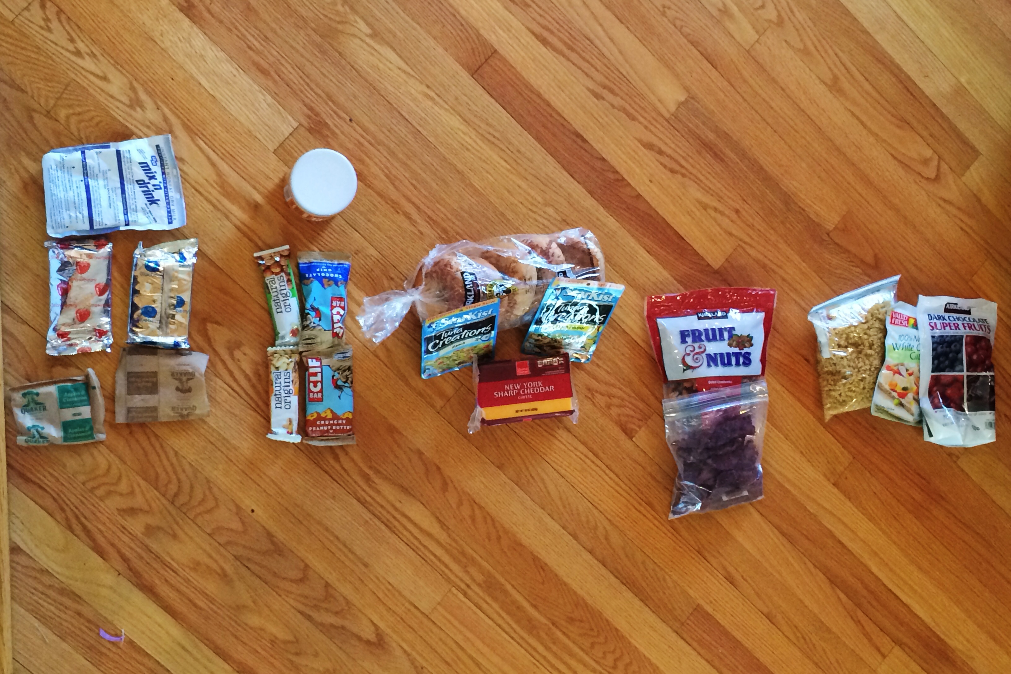
FOOD
This is the goods we’ll be eating on an average day. We’ve read that in the wintery/early spring days, you want to back about 2.5lbs of food per person, per day. We were also advised to take an extra days worth of food in the colder months in case we get stranded by snow or the like. So, that’s what we’re working with for now, though we’re sure it’ll change as we learn our own eating habits on the trail.
For breakfast (far left in the photo), we’ll have oatmeal with powdered milk and/or a childhood throwback — Pop Tarts! We may mix things up with a bagel and peanut butter as well. Lunch (center) will be crackers and/or bagels with cheese and tuna. We’ll probably put peanut butter on things too. Dinner (far right) this week is Annie’s mac & cheese with tuna or chicken — but we’ll probably add ramen and other instant pasta/rices when we resupply. And we’ll probably eat peanut butter. Throughout the day, we’ll be snackin’ on energy bars, dried fruit, nuts, and chocolate bits. And peanut butter… we like peanut butter.
CLOTHES(and water, and other misc gear in this pic…)
First of all — a big shout out to Georgeanna and Logan of Mountain Crossings at Neels Gap! These two are outfitters who hiked the AT a few years back, and they were instrumental in helping us get the right gear for this trip. Thank you, guys!
For hiking we’ll sport a light base layer, hiking pants, a layering shirt, a down jacket, a beanie, and fleece gloves with a waterproof shell. For the rainy days, we have rain jackets and rain pants. When we get to camp, we’ll change into a mid-weight wool base layer and a third pair of wool socks. This outfit will never be worn hiking to ensure we always have something warm and dry to sleep in (just say no to chills and hypothermia!). Some of these clothes will get ditched as the weather warms, meaning lighter weight as we hike. Woohoo!
For the feet: Katherine has waterproof trail running shoes, and Brandon has lightweight hiking boots. We will most likely go through multiple shoes as we go, so who knows what footwear we’ll have at the end. We both have Superfeet insoles, a must-have item according to long distance hikers. For our camp shoes, Bedrock Sandals generously gave us each a pair of their minimalist sandals!
Water and other misc gear in this pic: We each have a Platypus 3L water bladder with a Sawyer Squeeze inline water filter, and as of now we plan to bring an additional 1L bottle of water. When we bring an extra bottle or two will depend on water availability, which is generally pretty good for most of the Trail. In this photo, you can also see our basic first aid kit, toiletries bag, electronics bag, hiking poles, sunscreen and whistles.
CAMP GEAR
This photo has our essentials for setting up camp at the end of a long day. It’s all packed up in dry sacks, but here’s what we’ve got:
In the center is our AWESOME TENT — our home for the next few months! Gen from Yama Mountain Gear was so kind to let us to be ambassadors of his newly designed Swiftline tent. More pictures of our new home will follow, but it’s unlike any tent we’ve ever used and we love it!
On either side of the tent we have our Big Agnes Air Core insulated sleeping pads. Over three inches of air to sleep on. Yes. Please. Then, on the other side of our sleeping pads are our sleeping bags.Starting out in the early spring, we’ll be using super light, 15 degree down bags by Western Mountaineering. We’ll switch these out for a cooler bag in a few months.
Underneath you can see our cooking gear. From the left — we’ve got our denatured alcohol for our alcohol camp stove, which is right next to it. Then there’s our titanium pot with a top that acts as a pan — along with camp soap for washin’ dishes and SPORKS (not just for Taco Bell!) for eatin’! And then some knives to cut things and stuff.
Above all this we have some interesting tidbits. We’ve got TP and a large tent stake with which to dig a “cat hole” (you can figure this out on your own…), and the orange cord and carabiner will be used to hang our bear bags in trees so we don’t have any unwelcome visitors at night.
Oh, and…
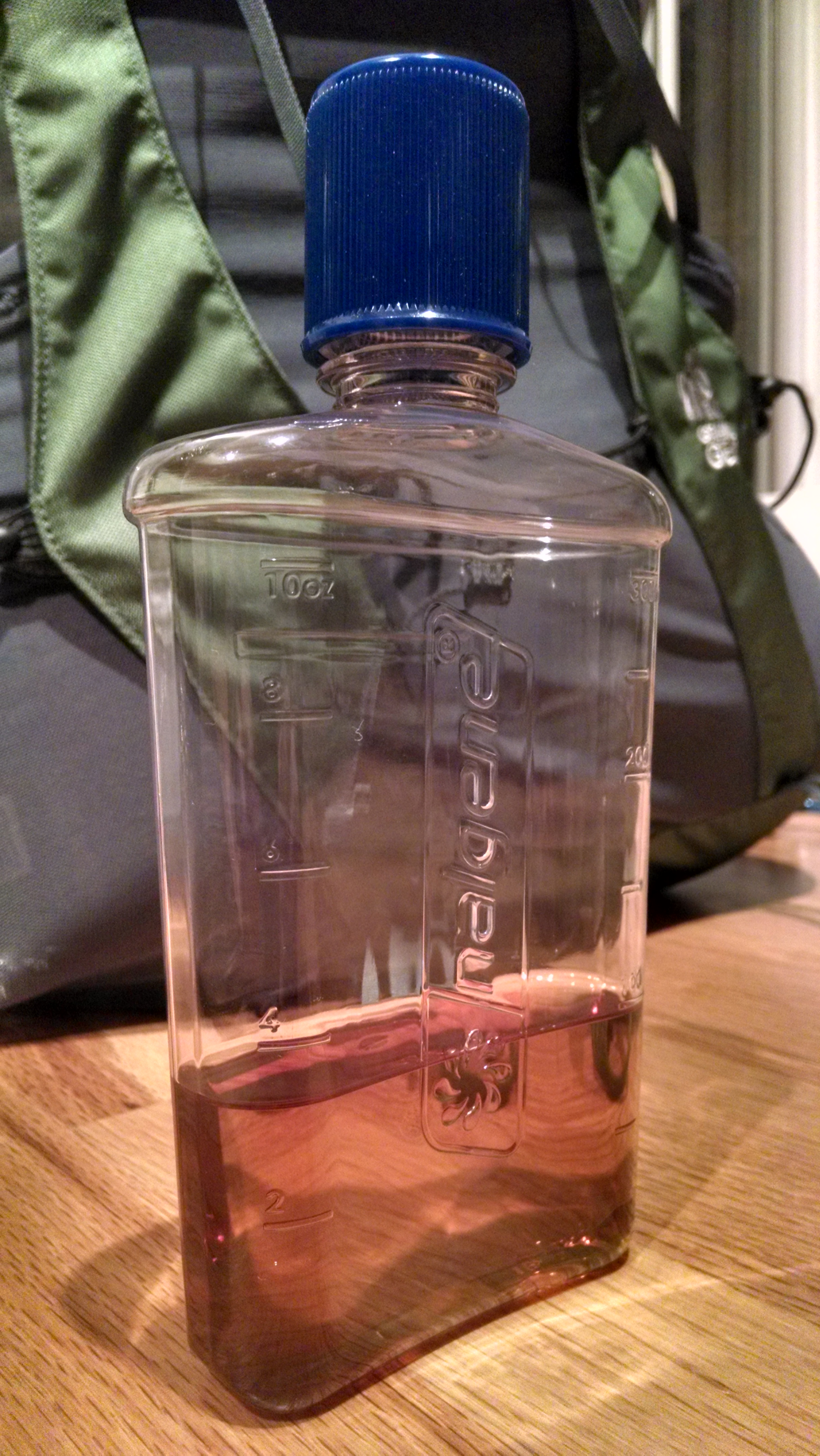
Let’s not forget the Nalgene flask so kindly given to us by Katherine’s uncle, George. We’re using it to bring some… apple juice for cold, wet nights.
That’s it for gear! Gotta go enjoy our last night in a warm bed for a bit! Happy trails!
Hi, and welcome to the blog of Brandon & Katherine’s excellent adventure! We plan to be ‘unplugged’ while hiking, but will upload photos and updates when we hit towns — about once a week or every two weeks.
We hope to hit the trail around March 11th. In the meantime, feel free to peruse the “Who we are,” “Why we’re hiking,” and “Made possible by” sections above.


